Why Google Maps Sometimes Shows Traffic That Doesn’t Exist
Google Maps doesn’t actually “see” traffic — it predicts it using GPS signals, smartphones, movement patterns, and algorithms. This blog explores how modern navigation apps estimate congestion and why they sometimes show traffic that doesn’t even exist.

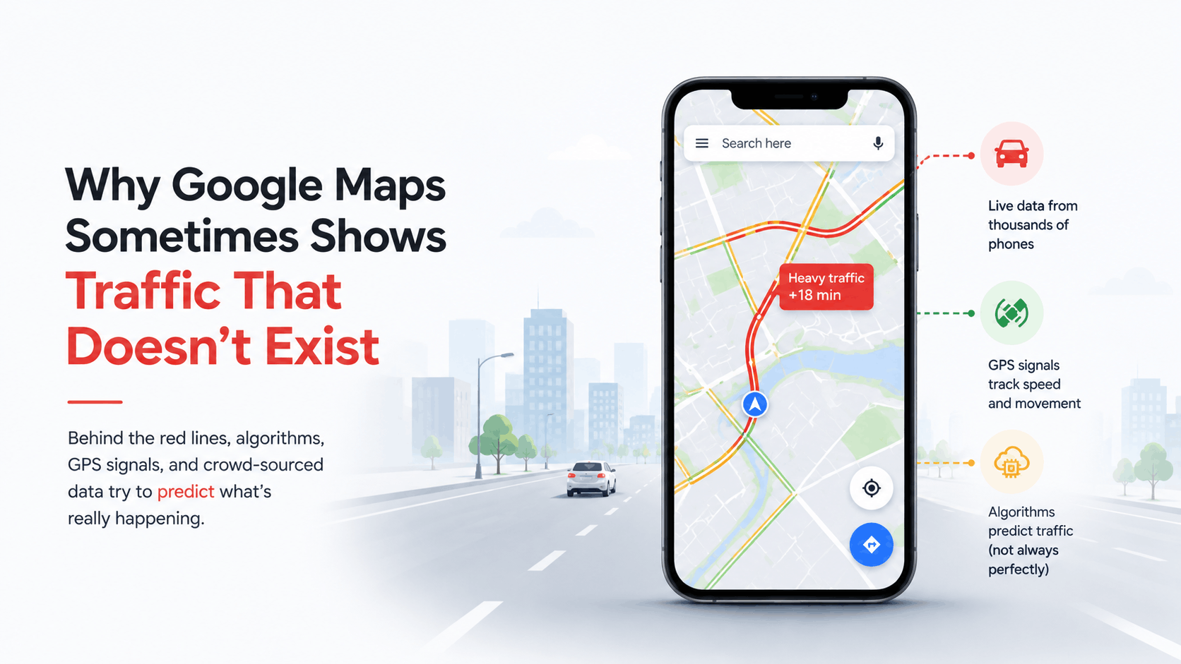
The hidden world of GPS signals, crowd-sourced data, prediction systems, and why modern navigation apps occasionally think empty roads are traffic jams
Introduction: The Road Looks Empty… But the Map Says “Heavy Traffic."
You open Google Maps before leaving home.
The road near your area suddenly appears:
bright red.
Heavy traffic.
Estimated delay:
18 minutes.
But then you actually go outside…
And the road is almost empty.
No massive traffic jam.
No accident.
No visible chaos.
Just normal traffic.
At that moment, almost everyone has the same thought:
“How does Google Maps even decide traffic exists?”
Because modern navigation apps feel almost magical most of the time.
They:
- predict routes
- estimate delays
- avoid congestion
- reroute drivers instantly
And somehow manage millions of moving vehicles simultaneously across entire cities.
But occasionally…
they get things very wrong.
Sometimes:
- traffic appears where nothing exists
- roads suddenly turn red randomly
- empty streets look congested
- routes behave strangely
And honestly?
That makes the system even more interesting.
Because the truth is:
Google Maps does not actually “see” traffic directly.
Instead, it predicts traffic using enormous amounts of behavioral and location data.
Which means traffic on maps is often not reality itself…
It’s an algorithmic interpretation of reality.
And sometimes,
Algorithms guess incorrectly.
The Most Important Thing to Understand
Google Maps does not have cameras watching every road continuously.
At least not everywhere.
Instead, much of modern traffic prediction comes from the following:
- smartphones
- GPS signals
- movement speed
- user density
- historical patterns
- machine learning systems
The map mostly understands traffic by observing movement behavior.
That’s the key idea.
Your Smartphone Quietly Helps Build Traffic Maps
Every smartphone using navigation apps becomes a tiny moving data point.
When users move with the following:
- GPS enabled
- mobile data active
- location services allowed
Their phones continuously send location updates.
Individually,
One phone means almost nothing.
But millions of phones together create traffic intelligence.
The Map Is Basically Watching Movement Patterns
Imagine 200 phones traveling on the same road.
Normally:
vehicles move at:
- 50 km/h
- 60 km/h
- smooth speed
Suddenly,
All those phones slow down to:
- 8 km/h
- 5 km/h
- stop-and-go movement
The system assumes:
“Something is causing traffic.”
That assumption usually works.
Usually.
Traffic Maps Are Mostly Probability Systems
This surprises many people.
Modern navigation systems don’t “know” traffic perfectly.
They estimate traffic probabilistically.
The app constantly asks:
- How fast are users moving?
- How many devices are nearby?
- Is this behavior unusual?
- Does it match historical congestion patterns?
Then algorithms generate traffic predictions.
Why Empty Roads Sometimes Turn Red
Now we reach the weird part.
Sometimes traffic appears even when roads seem empty.
This can happen because:
The system interprets slow movement incorrectly.
For example:
- delivery riders parked nearby
- people walking with phones
- buses stopping repeatedly
- GPS signal confusion
- construction interference
Algorithms may mistakenly conclude:
“Traffic congestion exists.”
Example: The Delivery Rider Problem
Imagine 40 food delivery riders waiting outside a restaurant cluster.
Their phones remain:
- close together
- moving slowly
- constantly active
To algorithm,
This behavior can resemble:
slow-moving traffic.
Even though actual road congestion may barely exist.
That’s one reason map systems occasionally behave strangely near busy commercial zones.
GPS Is Amazing… But Also Messy
Most people imagine GPS as perfectly accurate.
It isn’t.
GPS constantly deals with:
- signal reflections
- tall buildings
- tunnels
- weather interference
- weak satellite visibility
In dense cities,
GPS estimates may drift significantly.
That creates mapping confusion sometimes.
Tall Buildings Can Confuse Navigation Systems
Urban environments create something called:
“urban canyon effect.”
Signals bounce between buildings,
causing inaccurate location calculations.
This may lead apps to think the following:
vehicles are:
- slower
- misplaced
- stuck
- clustered incorrectly
Cities are difficult environments for navigation systems.
Why Traffic Changes So Fast on Maps
Traffic layers update continuously because:
Movement patterns constantly change.
Apps recalculate based on:
- live GPS data
- road conditions
- user density
- speed variations
That’s why roads may suddenly switch from:
green → orange → red
Within minutes.
Historical Data Quietly Shapes Predictions Too
Maps don’t rely only on live traffic.
They also analyze historical behavior.
For example:
if certain road becomes congested every day at 6 PM,
Algorithms may anticipate traffic before congestion fully forms.
Sometimes this improves prediction.
Sometimes it causes false assumptions.
Prediction Can Accidentally Become Self-Fulfilling
This is fascinating.
If app predicts traffic:
drivers avoid that route.
Suddenly:
the road becomes empty.
Meaning:
the prediction itself changed traffic behavior.
Modern navigation systems don’t just observe traffic anymore.
They influence it too.
Google Maps Quietly Became a Global Traffic Coordinator
Millions of drivers follow navigation suggestions simultaneously.
This means routing systems now influence:
- city traffic flow
- congestion patterns
- commuting behavior
That’s extraordinary influence for one app.
Routing Algorithms Constantly Solve Complex Problems
Modern map systems continuously optimize:
- fastest routes
- shortest routes
- fuel efficiency
- traffic avoidance
- road closures
At a massive scale.
And roads themselves constantly change.
That makes routing incredibly difficult.
Machine Learning Changed Navigation Completely
Older navigation systems were relatively static.
Modern systems increasingly use AI and machine learning to analyze the following:
- movement patterns
- congestion probability
- driving behavior
- road usage
This allows maps to become more adaptive.
But also more predictive.
Why Maps Sometimes Suggest Weird Routes
Everyone has experienced this.
Google Maps suddenly suggests:
- tiny side streets
- confusing shortcuts
- narrow roads
Sometimes routes feel absurd.
That happens because algorithms optimize mathematically.
Not emotionally.
The system often values the following:
- time savings
- traffic reduction
Even if humans dislike certain roads.
Example: The “2-Minute Faster” Obsession
Imagine:
main road = predictable but slower
side road = chaotic but mathematically faster
Algorithms may choose the side road repeatedly.
Because systems optimize efficiency,
not comfort.
Humans think:
“That route feels terrible.”
Algorithms think:
“Technically faster.”
Smartphones Quietly Created Real-Time Navigation
Before smartphones,
Maps were mostly static.
Now phones continuously provide:
- live speed data
- route feedback
- traffic density
- incident reports
Modern navigation became crowd-powered infrastructure.
That’s a huge shift.
Crowdsourced Data Became Incredibly Powerful
Apps rely heavily on users themselves.
People unknowingly contribute:
- speed patterns
- movement data
- traffic reports
- road closures
Every driver becomes part of the traffic intelligence system.
Why One Person Can Accidentally Affect Traffic Data
There’s actually a famous story:
someone slowly walked dozens of phones through streets,
causing maps to display fake traffic congestion.
Why?
Because the algorithm interpreted clustered slow devices as vehicle congestion.
That experiment revealed something important:
Maps understand traffic through behavioral signals,
not direct visual understanding.
The Internet Quietly Powers Modern Navigation
Every map interaction depends on:
- cloud servers
- location databases
- routing systems
- APIs
- real-time synchronization
Navigation apps are basically giant distributed computing systems.
Maps Need Massive Infrastructure
Modern mapping systems manage the following:
- billions of locations
- live movement data
- satellite imagery
- traffic updates
- route calculations
At a global scale.
That computational challenge is enormous.
Why GPS Drains Battery So Fast
Constant location tracking requires:
- satellite communication
- sensor processing
- network updates
Navigation apps continuously balance the following:
- accuracy
- battery efficiency
- update frequency
That optimization itself is technically difficult.
Navigation Apps Quietly Predict Human Behavior
Maps increasingly predict:
- likely destinations
- commuting patterns
- departure times
- preferred routes
Sometimes your phone suggests a route before you even search.
That’s behavioral prediction in action.
AI May Eventually Predict Traffic Before It Happens
Future systems may increasingly analyze the following:
- weather
- public events
- city patterns
- historical congestion
- real-time movement
To predict traffic proactively.
Not reactively.
That future is already partially happening.
Self-Driving Cars Depend on Even More Accurate Mapping
Autonomous vehicles require:
- extremely detailed maps
- real-time awareness
- accurate positioning
- prediction systems
Navigation technology is becoming foundational infrastructure for future transportation.
The Most Interesting Part
Modern maps are not just maps anymore.
They became:
- prediction systems
- behavioral analysis platforms
- traffic coordination engines
- real-time city simulations
And most users simply see:
a colored road.
That’s honestly incredible.
Why “Fake Traffic” Is Actually a Side Effect of Intelligence
The strange traffic errors happen because maps are trying to interpret reality from incomplete information.
The system constantly estimates:
- movement
- congestion
- probability
- behavior
An estimation is never perfect.
Ironically,
the smarter systems become,
The more visible prediction mistakes sometimes feel.
Final Thoughts
Google Maps feels magical because it transforms billions of messy real-world signals into understandable navigation guidance.
Behind every traffic color exists the following:
- GPS tracking
- cloud computing
- machine learning
- behavioral prediction
- crowd-sourced data
- routing algorithms
Working together constantly.
When traffic appears incorrectly,
It's usually not because the app is broken.
It’s because modern navigation systems are trying to understand chaotic human movement at a planetary scale.
And honestly?
That’s an incredibly difficult problem.